
St. Joseph Neighbors: Block Records
Block-level research starts with the official map and works outward one parcel at a time. The geographic record can show parcel outlines, situs labels, owner-name layers, roads, rights-of-way, water features, and neighborhood context. It is not a roster of people who live on the block. The owner shown on a tax or GIS layer may be a trust, company, or mailing contact, while a map only locates land within a selected geography.
| Block source | What it can show about a block | Access and limit |
|---|---|---|
| Buchanan GIS parcel layers | Adjacent polygons, parcel numbers, owner and situs layers, roads, rights-of-way, and subdivision context | Public map; historical archive dates are not fully published |
| Property Tax Inquiry | Current parcel or owner-label search by house number, street, city, or owner | Public form; it is not an occupancy record |
| Voter precinct register | Permitted voter fields, precinct, township, ward, and street or alphabetical inspection arrangement | Legally bounded inspection; protected addresses apply |
| City neighborhood map | Named-neighborhood context around a block | Broad map vocabulary, not parcel assignments |
| Sanborn, atlas, and directory street index | Dated street, building, and historical address leads | Selected years and year-specific entries |
For St. Joseph neighbors, treat each result as a separate observation. An adjacent parcel identifies a neighboring tract of land, not a relationship between people. A voter or directory result is also dated and limited. Keeping those categories separate avoids turning a block map into an unsupported account of occupancy.
Mapping St. Joseph Neighbors by Parcel
The adjacent-parcel method begins with the street address, then follows the parcel geometry instead of assuming that nearby mailing addresses describe the same block. The Buchanan County GIS is the public map route, and the property search supplies a second current record type. Preserve the address spelling, date, parcel number, and map layers used. Where the live result panel does not expose a field, record that as a gap rather than supplying it from another source.
- Enter the address components in Property Tax Inquiry and note the returned parcel or owner label if one appears.
- Open the same place in the GIS map and identify the focal parcel by its visible geometry, situs, or parcel layer.
- Click surrounding parcel polygons one at a time, saving only the parcel identifiers and public owner or situs labels needed for geographic comparison.
- Compare the resulting block with road, right-of-way, water, subdivision, and corporate-limit layers before describing the setting.
- Use recorder instruments for title questions and dated directories or maps for historical context, without turning either into present-occupancy proof.
When the question expands from the immediate parcels to a full named street, the St. Joseph Street Directory provides the broader address-record workflow. The block method stays narrower: parcel-to-parcel geography first, followed by only the record type that answers the next specific question.
St. Joseph GIS Layers for Neighbors
The county’s GIS REST overview identifies a broad set of layers useful for reading the ground around a St. Joseph block. Property layers include parcel, parcel number, acres, situs address, owner name, values, subdivision, original lot, tract, and map block. The same service also lists road and rail layers, right-of-way, streams, water boundaries, levees, cemeteries, churches, historic places, corporate limits, and unincorporated towns.
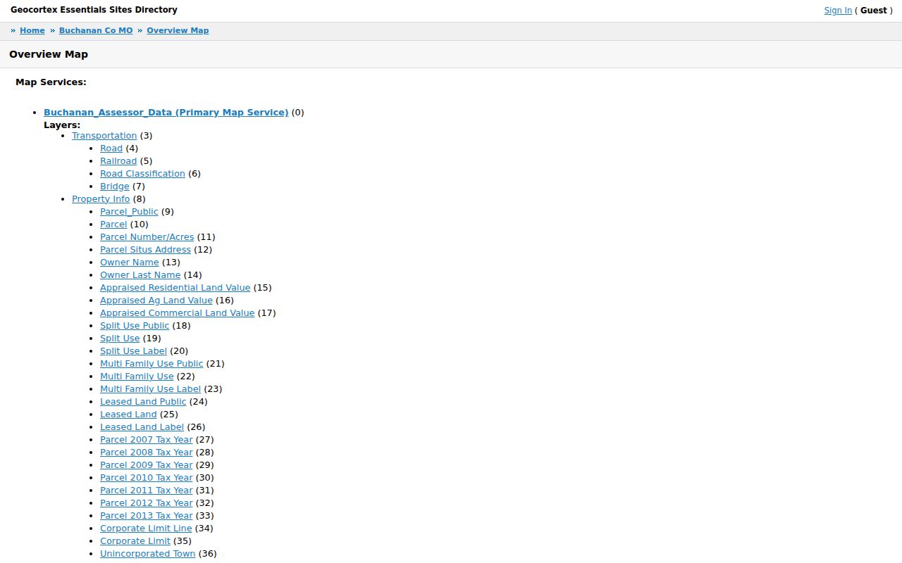
The layer list makes it possible to describe why parcels are next to each other, separated by a road, or divided by a rail or water feature. It does not reveal a social connection. The current map is useful for a present geographic view, while its published text did not expose exact live search-widget labels or all parcel-result fields.
St. Joseph Neighborhood Map Context
A St. Joseph address can sit in four different map systems at once: a postal ZIP, the assessor’s parcel and situs, the city corporate limit, and a named neighborhood. Those labels should not be swapped. A postal result supports delivery geography. A GIS corporate-limit layer supports whether a parcel lies within a city boundary. The parcel layer identifies the tract, and the neighborhood map supplies a broader local name.
The city’s neighborhood map lists 65 named areas, including Museum Hill, Old Town North, Cathedral Hills, Downtown, Midtown, and Robidoux Hill. It is a valuable vocabulary for discussing St. Joseph neighbors, but no official parcel-by-parcel neighborhood assignment table was located. For an outlying postal address, compare an address-level USPS result with the GIS corporate-limit and unincorporated-town layers before assigning city geography.
St. Joseph Neighbor Association Routes
Community organizations add institutional context, not a count of every neighbor or resident. The Museum Hill organization offers a concrete example of a neighborhood route, while the Downtown Association maintains a member directory. Membership, event attendance, or a map label should never be used to infer who occupies a parcel. Use these routes when the question is about community activity, historic-area context, or an organization’s public contact path.
Museum Hill Association
Museum Hill’s public involvement page lists monthly meetings, cleanup and community events, plus individual and business membership information. It gives a community route for the historic area, not a resident roll.
Downtown Association
The Downtown Association member directory identifies participating organizations. It can help interpret a business or civic reference, but selective membership is not neighborhood coverage.
Museum Hill is also listed by the city among its historic-neighborhood context, with contributing structures developed roughly from 1860 to 1942. That is a built-environment fact. It does not identify past or present occupants of any one structure.
Voter Records for St. Joseph Neighbors
Missouri law allows precinct registers to be arranged alphabetically or by street and inspected at reasonable times under RSMo 115.163. The related public-field rule in RSMo 115.157 includes protections for certain addresses, and the voter-law framework restricts commercial use. Ask the Buchanan County Clerk & Election Authority about a specific election year or precinct register rather than requesting a broad list of people around an address.
The state voter portal is an exact registration check that uses first name, last name, date of birth, last four Social Security digits, and county. Those identifiers must not be published or shared. A registration match supports only a record presence on the lookup date. It does not prove current occupancy, a connection to adjacent parcels, or a relationship among St. Joseph neighbors.
St. Joseph Neighbor Block Changes
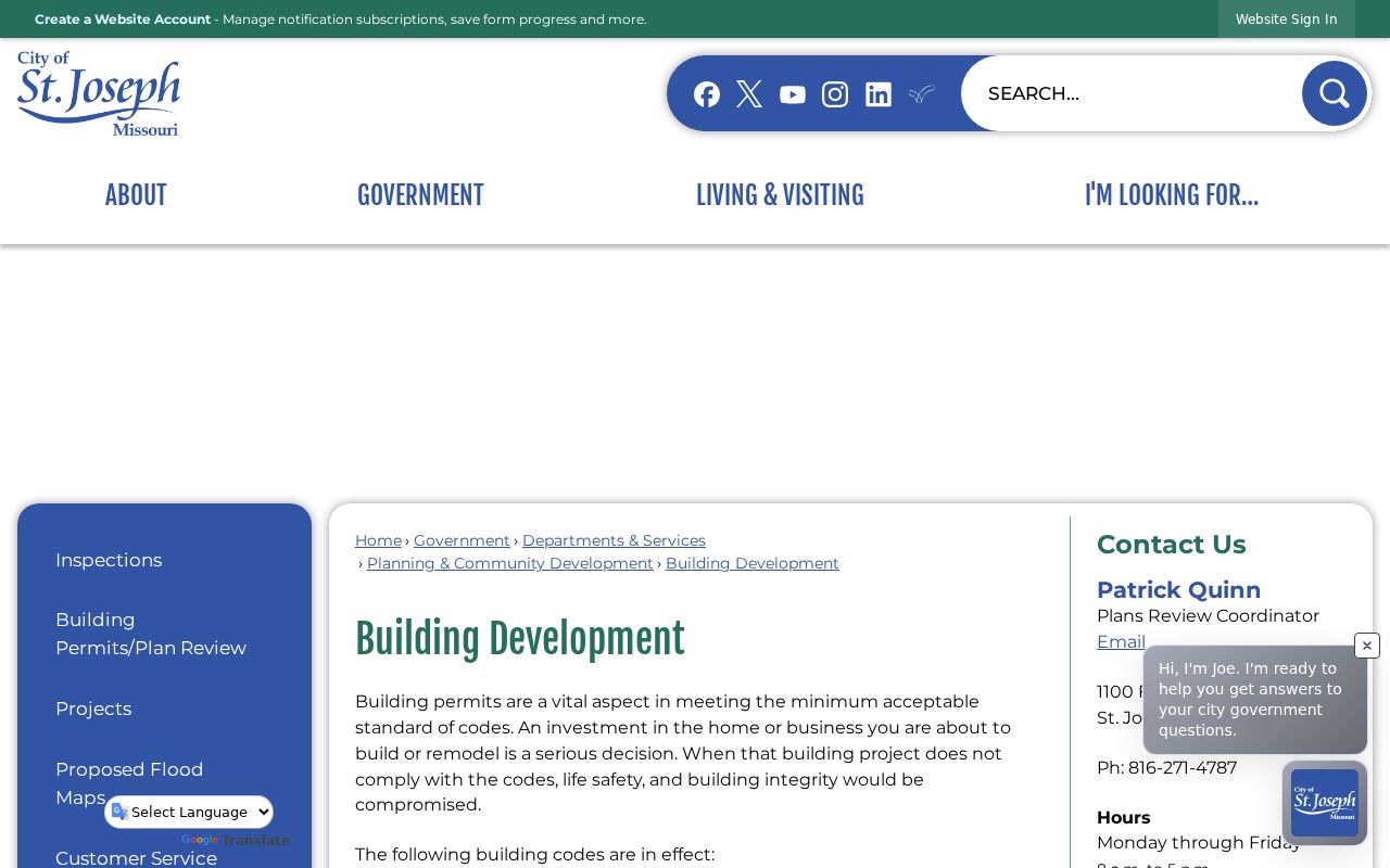
The St. Joseph Building Development page identifies permit triggers for work such as decks, fences, pools, roofing, additions, garages, electrical, plumbing, and structural work. It can explain a physical change near a block, but it is not a public people search. No public searchable city permit-case portal, complete permit index, or universal permit-image archive was located in the research.
For a dated property question, request a narrow address or parcel range from the Building Division or city custodian and ask for releasable permit number, issue date, type, inspection status, and closure information. A permit applicant is not necessarily an owner or occupant, so keep the administrative record separate from the neighbor map.
Historic St. Joseph Neighbor Blocks
Historic-area context is another map layer, not a resident list. The city’s historic-neighborhoods material names Museum Hill, Old Town North, the Hall Street Local Historic District, and the Cathedral Hill National Historic District, along with brick-street and Mt. Mora context. Buchanan GIS also identifies a Historic Place layer. Together, those sources can explain the physical or preservation setting around a St. Joseph block.
Use a dated Sanborn sheet or the 1877 atlas when the question is how a block looked in an earlier era. The map may show buildings, street names, alleys, and adjacent structures, while a current parcel map shows today’s geometry. Neither map identifies a household. Where an address crosses a historic-district label, parcel boundary, or named neighborhood, report each geography independently rather than treating the labels as interchangeable.
St. Joseph Neighbor Tool Comparison
Official sources and commercial neighbor tools serve different purposes. A current county or city source identifies its custodian, record type, and access limit. Commercially compiled tools may combine records from different dates and may not show the original source or the reason a field changed. For a block question, use the official geography first and preserve the source date.
| Source category | Best use | Key limit |
|---|---|---|
| Official GIS and property records | Parcel geometry, situs, owner label, and mapped context | Owner labels do not prove occupancy or relationships. |
| Election records | Narrow, lawful registration or precinct research | Protected addresses and use rules control access. |
| Commercially compiled neighbor tools | A prompt to verify a source independently | Coverage, dates, matching, and correction practices can vary. |
Note: A source that cannot identify its record date or custodian should not be used to make a block-level claim.
St. Joseph Neighbor Lookup Limits
Protected addresses, sealed court material, restricted vital information, and Missouri Safe at Home records are boundaries. Safe at Home participants may use a substitute address in government and court records. An omitted result or different address may be intentional. Do not seek a workaround, combine personal details, or turn public map layers into a monitoring tool.
Keep a block report to the minimum necessary facts: parcel identifier, map layer, source date, and a precise statement of what the record shows. A property owner, voter registrant, directory entry, or permit applicant may each be a different person. The useful conclusion is often geographic, such as a parcel’s adjacency or its location inside a named area.
Lawful use. St. Joseph neighbor research is for lawful personal, community, and civic purposes. Never use public-record details to follow, harass, threaten, intimidate, or alarm another person.